Exploring the Mid-Atlantic Ridge: Iceland's Geological Marvel
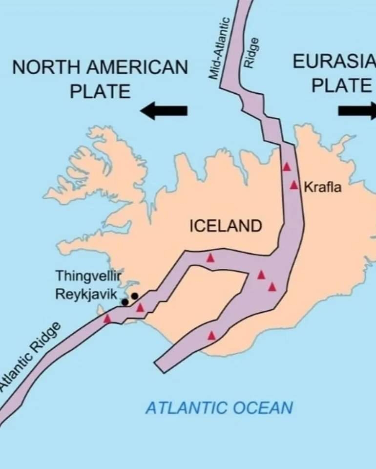
The Mid-Atlantic Ridge, stretching across the Atlantic Ocean floor, is a pivotal feature in the Earth's geology, marking a divergent boundary where tectonic plates pull apart. Spanning approximately 10,000 miles (16,000 km), it holds the distinction of being the longest mountain range globally. This ridge serves as the boundary line between the North American and Eurasian Plates to the north, and the African Plate to the south, notably discernible at the Azores Triple Junction. Through the mechanism of seafloor spreading, magma rises from beneath the Earth's crust, creating new oceanic crust and pushing the existing plates away from the ridge axis.
The continuous movement of tectonic plates away from the Mid-Atlantic Ridge contributes to the gradual widening of the Atlantic Basin. This process, estimated to occur at a rate of 1 to 10 cm (0.5 to 4 inches) annually, leads to the expansion of the ocean floor. As the plates move apart, magma wells up to fill the void, forming new crust. Over time, this process has played a significant role in shaping the Earth's surface and the distribution of continents and oceans.
While much of the Mid-Atlantic Ridge lies beneath the ocean's surface, Iceland stands as a remarkable exception. Here, the ridge emerges above sea level, showcasing its geological features prominently. Iceland's landscape bears witness to the forces of tectonic activity, with rifts, volcanic peaks, and geothermal phenomena defining its terrain. The island serves as a living laboratory for scientists studying the processes of plate tectonics and offers a tangible reminder of the dynamic forces at work beneath the Earth's crust.


Comments
Post a Comment
Comment